The Sky’s the Limit: Navigating the Complexities of Drone App Development
Drones, or unmanned aerial vehicles (UAVs), have transcended their origins as niche gadgets to become transformative tools across countless industries. From revolutionizing agriculture and construction to enhancing public safety and enabling rapid disaster response, the potential applications are vast and growing. However, harnessing this potential requires more than just an off-the-shelf drone; it demands sophisticated, reliable, and secure software to control, manage, and interpret the data these devices collect. The central challenge lies in developing a drone application that is both powerful and user-friendly.
The path to creating a successful drone app is fraught with technical hurdles. It involves complex integrations with diverse hardware, navigating a labyrinth of regulations, ensuring robust cybersecurity, and processing immense volumes of data in real time. For many businesses, attempting this in-house can quickly become a resource-draining endeavor that diverts focus from their core operations.
This article serves as a comprehensive guide to the world of drone app development. We will explore what a drone app entails, dissect the significant challenges of in-house development, survey the diverse types of applications by industry, and provide a realistic breakdown of development costs. Most importantly, we will introduce the leading companies in this space and explain how an expert partner can be the key to your success. As a top US AI-powered app development firm with over two decades of experience, we at metacto specialize in integrating complex technologies like drone systems into seamless mobile experiences. We are here to help you transform your vision into a market-ready product that takes flight.
What is a Drone App?
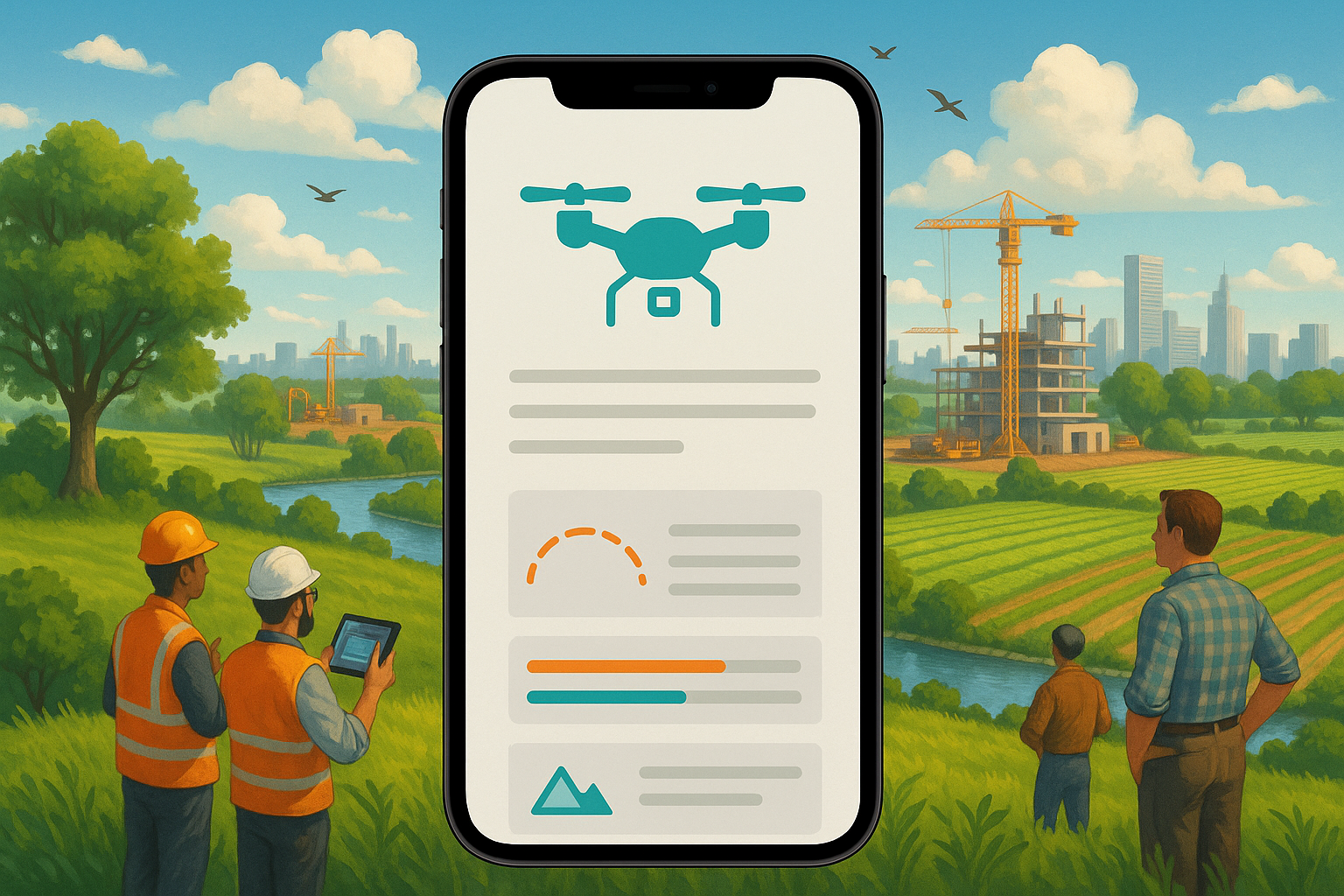
At its core, a drone application is the software bridge between a human operator (or an automated system) and a drone. It is the command and control center that enables users to pilot the UAV, manage its onboard systems, view its camera feed, and process the data it captures. A well-designed drone app transforms a powerful piece of hardware into a practical, intelligent tool capable of performing specific, high-value tasks.
The functionality of a drone app can range from simple to extraordinarily complex, but most professional applications include several key components:
- Flight Control and Navigation: This is the most fundamental feature, allowing a pilot to manually control the drone’s movement. More advanced apps provide automated flight planning, enabling users to create pre-determined flight paths using waypoints on a map. This is crucial for systematic tasks like surveying a construction site or mapping an agricultural field.
- Real-Time Data Streaming: Drone apps provide a live video feed (First-Person View or FPV) from the drone’s camera to the operator’s device. This is essential for situational awareness, navigation, and manual inspections.
- Data Capture and Management: Operators use the app to control the drone’s sensors—such as high-resolution cameras, thermal imagers, or multispectral sensors—to capture images, videos, and other data. The app then stores and organizes this data, often syncing it to a cloud platform for further analysis. Companies like AirData, for instance, manage data from over 36 million flights, highlighting the scale of data involved.
- Data Processing and Analysis: The true value of a drone is often unlocked after the flight. Modern drone apps, or their companion cloud platforms, incorporate powerful software to process the captured data. This can include stitching thousands of images together to create high-resolution 2D maps and 3D models (a process known as photogrammetry), analyzing thermal data to find hotspots on solar panels, or using AI to count crops.
- Fleet Management: For organizations that operate multiple drones, a robust app provides a centralized dashboard to manage the entire fleet. This includes tracking the status, maintenance schedules, flight logs, and pilot assignments for each drone, as seen in platforms like Drone Logbook.
- Connectivity and Integration: Drone apps rely on a stack of technologies to function, including GPS for positioning and wireless networks (like Wi-Fi, 4G/5G, or proprietary radio links) for communication between the controller, the drone, and the cloud. Leading platforms like Votix are hardware-agnostic, meaning they can operate with drones from various manufacturers, offering greater flexibility.
Essentially, a drone app is the brain of the entire UAV operation, translating high-level business goals into precise aerial maneuvers and transforming raw aerial data into actionable intelligence.
Why In-House Drone App Development is So Difficult
Building a functional app is one thing; building a secure, scalable, and compliant drone application is another challenge entirely. While the DIY approach can seem appealing, many organizations underestimate the deep, multi-disciplinary expertise required. Here are the primary reasons why developing a drone app in-house is a significant undertaking.
Overcoming Technical Complexity and Integration Hurdles
Modern drones are complex systems, and integrating an app with them requires deep knowledge of their specific Software Development Kits (SDKs). Each major drone manufacturer (like DJI, Skydio, or Parrot) has its own SDK with unique protocols and limitations. Building an app that works seamlessly across different hardware models—a feature users often expect—multiplies this complexity. Furthermore, developers must manage real-time, low-latency data streams for video and telemetry, which is a non-trivial engineering challenge that demands expertise in network protocols and data compression.
Navigating Severe Security Vulnerabilities
Security is not an afterthought in drone development; it is a fundamental requirement. Drones are cyber-physical systems that rely on GPS, cloud connectivity, and wireless networks. Each of these is a potential attack vector. The provided facts highlight critical risks:
- GPS Spoofing: Hackers can transmit fake GPS signals to trick a drone into thinking it is somewhere else, causing it to fly off-course, crash, or even be hijacked.
- Unauthorized Access: A poorly secured communication link can allow an attacker to take control of the drone, potentially using it for malicious purposes or causing a dangerous accident.
- Data Breaches: Drones often capture sensitive information, from critical infrastructure inspection data to detailed images of private property. A breach in the app or its cloud backend could expose this data, leading to corporate espionage, privacy violations, and significant liability.
Building a secure drone ecosystem requires end-to-end encryption, robust authentication protocols, and continuous security auditing—skills that are often outside the scope of a generalist app development team.
Ensuring Regulatory and Compliance Adherence
The airspace is a highly regulated environment. In the United States, the Federal Aviation Administration (FAA) governs all commercial drone operations. These regulations cover everything from where and when you can fly to pilot certification and remote identification (Remote ID) requirements. Drone apps must often incorporate features to ensure compliance, such as geofencing to prevent flight in restricted areas (like airports or military bases) and automated logging to maintain meticulous flight records for auditing. The estimated cost for regulatory compliance alone ($10,000 to $20,000) underscores its complexity. Companies like AutoPylot and Altitude Angel have built entire businesses around helping pilots navigate this legal landscape.
Integrating and Processing Advanced Sensor Data
The true power of commercial drones comes from their payloads. This includes a wide array of specialized sensors:
- High-Resolution Cameras for detailed visual inspections.
- Thermal Cameras for detecting heat signatures (e.g., faulty electrical components, heat loss in buildings, or locating people in search and rescue).
- Multispectral and Hyperspectral Cameras (like those used by Gamaya) for analyzing light beyond the visible spectrum, crucial for assessing crop health in agriculture.
- LiDAR (Light Detection and Ranging) for creating incredibly precise 3D maps and models.
Integrating these sensors and, more importantly, building the software to process and interpret their data is a highly specialized field. It often requires knowledge of computer vision, data science, and AI/machine learning. This is why sensor integration is one of the more expensive components of drone app development, estimated at $20,000 to $40,000.
Hiring an expert development agency like metacto mitigates these risks. With over 20 years of experience in mobile app development and a deep focus on AI, we possess the specialized knowledge to tackle these challenges. We understand how to build secure systems, navigate complex integrations, and turn raw data into valuable insights. Our approach, which can include delivering a Rapid MVP Development in as little as 90 days, allows you to validate your concept and go to market faster and more cost-effectively than attempting to build a specialized team from scratch.
Diverse Applications: Types of Drone Apps by Industry
Drone applications are not one-size-fits-all. They are tailored to the specific needs and workflows of different industries, turning UAVs into indispensable tools for efficiency, safety, and data collection. Here is a look at how drone apps are making an impact across various sectors.
Construction and Infrastructure Inspection
The construction industry has embraced drone technology to oversee projects from groundbreaking to completion.
- Progress Monitoring: Drones provide a bird’s-eye view of a job site, allowing project managers to track progress against timelines, ensure work adheres to specifications, and quickly identify potential delays. Platforms like DroneDeploy and Skycatch excel at this, providing actionable data to managers.
- Mapping and Surveying: Drones can cover large areas quickly, capturing high-resolution imagery to create detailed topographic surveys and 3D site models. This data is invaluable for site planning and is a core feature of software like Trimble Stratus.
- Safety and Inspection: Drones can safely inspect hard-to-reach structures like bridges, tall buildings, and roofs, identifying structural issues or potential hazards without putting human inspectors at risk.
Energy Sector
From fossil fuels to renewables, the energy sector relies on drones for safe and efficient maintenance of its vast infrastructure.
- Asset Inspection: Drones are used to inspect solar panels, wind turbines, and thousands of miles of power lines. They can detect physical damage, such as cracks in a turbine blade or a fault in a solar panel, far more quickly than ground crews.
- Thermal Analysis: Equipped with thermal cameras, drones can identify hotspots on power lines or solar arrays, which often indicate electrical faults or inefficiencies that are invisible to the naked eye. Companies like Raptor Maps specialize in providing this type of advanced software for the solar industry.
Agriculture
Precision agriculture, powered by drone technology, helps farmers increase yields, reduce costs, and practice more sustainable farming.
- Crop Health Monitoring: Drones with multispectral cameras can detect subtle changes in plant health, identifying issues like nutrient deficiencies, pest infestations, or disease before they spread. Gamaya’s hyperspectral technology offers even more powerful data for this purpose.
- Irrigation Optimization: By analyzing soil conditions and plant stress, drone data helps farmers identify areas that need more or less water, conserving a precious resource and improving crop outcomes.
- Data-Driven Farming: Apps collect and analyze data on soil conditions, irrigation, and plant health, enabling farmers to move from reactive to proactive management, taking corrective action early to protect their yield.
Public Safety and Emergency Response
Drones provide critical situational awareness when seconds count.
- Law Enforcement: Police departments use drones for a range of missions, including crowd monitoring at large events, providing real-time intelligence during hostage or active shooter incidents, and creating detailed 3D reconstructions of accident sites.
- Search and Rescue: Drones can cover large, difficult-to-access areas quickly to locate missing persons. They can also deliver critical supplies like food, water, or medical equipment to stranded individuals.
- Disaster Management: In the aftermath of a natural disaster, drones are deployed to rapidly assess the extent of the damage, find victims, and help plan recovery efforts. This data can also be used for disaster risk management, identifying vulnerable areas to mitigate the impact of future events.
Environmental Monitoring and Conservation
Drones are a powerful, non-invasive tool for protecting our planet.
- Ecosystem Health: Conservationists use drones to track the health of forests, wetlands, and other ecosystems. They can monitor deforestation, assess the impact of development, and support reforestation efforts.
- Wildlife Tracking: Drones help researchers monitor wildlife populations, track their movements, identify breeding grounds, and assess the impact of climate change on their habitats, all without disturbing the animals.
- Anti-Poaching Efforts: In the fight against illegal activities like poaching and logging, drones provide a crucial surveillance advantage, helping law enforcement monitor vast territories and catch criminals.
Logistics, Delivery, and Telecommunications
- Medical and Cargo Delivery: Drones are being deployed to transport high-value, time-sensitive items like medical samples, medications, and organs. They are also being used for general cargo delivery, with companies like Pablo Air proving the concept of long-distance delivery over the ocean.
- Telecom Infrastructure Inspection: UAVs equipped with high-resolution cameras can safely inspect cell towers and antennas, identifying damaged equipment or vegetation encroachment that could disrupt service.
The Bottom Line: Cost Estimate for Developing a Drone App
Developing a professional-grade drone application is a significant investment. The total cost is influenced by the complexity of the features, the number of platforms (iOS, Android, Web), the level of security required, and the development team’s rates. Based on industry data, we can break down the estimated costs for each phase of the development lifecycle.
The following table provides a general estimate. Keep in mind that a simple app with basic flight controls will be at the lower end of this spectrum, while a sophisticated, multi-featured platform with AI analytics will be at the higher end or beyond.
| Development Phase | Estimated Cost Range |
|---|---|
| Requirement Analysis | $5,000 - $10,000 |
| Design and Planning | $8,000 - $15,000 |
| Prototyping | $10,000 - $20,000 |
| UI Design | $15,000 - $30,000 |
| UX Design | $10,000 - $20,000 |
| Core Software Development | $50,000 - $100,000 |
| Integration of Sensors | $20,000 - $40,000 |
| Testing and Quality Assurance | $15,000 - $25,000 |
| Documentation | $5,000 - $10,000 |
| Regulatory Compliance | $10,000 - $20,000 |
| Project Management | $10,000 - $15,000 |
| Marketing and Promotion | $10,000 - $20,000 |
| Contingency (10-15%) | $5,000 - $10,000 |
| Miscellaneous Expenses | $5,000 - $10,000 |
| Maintenance and Updates (Annual) | $10,000 - $20,000 |
| Total Estimated Cost | $193,000 - $383,000 |
This total represents a substantial investment, reinforcing the importance of getting it right the first time. Working with an experienced partner like metacto can help optimize this budget. Our established processes for design, development, and project management create efficiencies that reduce waste. Furthermore, our focus on launching a 90-day MVP helps you validate your core business assumptions with real users before committing to the full development cost, ensuring your investment is directed toward features that deliver real value.
Top Drone App Development Companies and Platforms
The drone software ecosystem is rich with innovative companies, each specializing in different aspects of UAV operations. While some offer complete, off-the-shelf platforms, others provide the underlying technology and development services to build custom solutions.
1. metacto
While many companies focus solely on drone-specific platforms, we at metacto specialize in a different, often more critical area: integrating powerful drone functionality into new or existing mobile and web applications. We are experts in custom mobile app development and AI, making us the ideal partner for businesses that see drones as a vital component of a larger digital strategy, not just a standalone tool.
Our approach is built on a foundation of over 20 years of experience in app development, having successfully launched over 120 projects. We understand that the real power of drone data is unlocked when it’s seamlessly integrated with your existing business workflows, CRMs, and analytics dashboards.
What sets us apart is our proven expertise in:
- Complex AI Integration: Modern drone apps rely heavily on AI and computer vision for tasks like object recognition, automated inspection analysis, and data interpretation. Our work on projects like the G-Sight training app, which uses cutting-edge computer vision, demonstrates our ability to implement sophisticated AI that delivers tangible results.
- Full-Lifecycle Partnership: We don’t just build and hand over code. We partner with you through every step, from initial strategy and product discovery to launch, growth, and monetization. We can act as your Fractional CTO, providing the high-level technical guidance needed to align your drone strategy with your core business goals.
- Speed and Efficiency: Our streamlined 90-day MVP process is designed to get your product to market quickly, allowing you to test your ideas, gather user feedback, and demonstrate traction to investors without a massive upfront investment.
If your goal is to build a comprehensive mobile solution that leverages drone technology to create a competitive advantage, we are the partner to help you achieve it.
Other Leading Drone Software Companies
Here are some of the other key players shaping the drone software industry, each with a unique focus:
- AirData: One of the largest online platforms for drone fleet data management and real-time flight streaming, serving over 310,000 users. It excels at logging, analyzing, and storing high-resolution flight data.
- Aloft (formerly Kittyhawk): A pilot-centric platform that serves as a one-stop-shop for flying, logging, and coordinating UAV operations, known for its user-friendly design.
- Altitude Angel: A leading aviation technology company focused on safely integrating autonomous drones into global airspace through its U-Space and UTM (Unmanned Traffic Management) cloud platform.
- DroneDeploy: A powerful, hardware-agnostic, cloud-based software that allows users to easily map job sites, create 3D models, and analyze data directly from their device.
- Pix4D: A commercial leader in photogrammetry software. Backed by years of scientific research, Pix4D’s software turns images from any source into professional-grade, customizable 2D maps and 3D models.
- Skycatch: Provides actionable data and visual intelligence to help construction managers and engineers fine-tune their operations, with a mission to help people operate faster, safer, and smarter.
- Trimble Stratus: A drone data platform built on Trimble’s decades of experience in the construction industry. It helps worksites map, measure, and share accurate information about their assets.
- Votix: An American drone software company that developed the first hardware-agnostic platform capable of delivering true end-to-end drone automation, orchestration, and remote operation.
Taking Your Vision to the Skies with an Expert Partner
We have journeyed through the intricate landscape of drone app development, from its core definition and industrial applications to the significant challenges and costs involved. The key takeaway is clear: while the opportunities presented by drone technology are immense, realizing them requires deep technical expertise, strategic planning, and a steadfast focus on security and compliance.
Developing a drone application is not a simple coding project; it’s a complex systems integration challenge. It involves harmonizing hardware, software, cloud infrastructure, and AI-powered analytics into a single, cohesive solution. For many businesses, the most effective and efficient path forward is not to build this capability from the ground up, but to partner with a team that has already mastered these complexities.
At metacto, we specialize in exactly that. We bring two decades of mobile app development experience and cutting-edge AI expertise to the table. We don’t just build apps; we build robust, scalable, and monetizable digital products. Our unique strength lies in integrating sophisticated drone functionality into your broader business strategy, ensuring the data you collect in the air drives real value on the ground.
Ready to integrate powerful drone capabilities into your product? Talk with an expert at metacto today to discuss your vision and build a technology roadmap for success. Let’s build your app the right way, from day one.